GRAND RAPIDS, Mich. (WOOD) — This fall, Storm Team 8 Chief Meteorologist Emeritus Bill Steffen marks 50 years of forecasting in West Michigan. During that time, he has seen the technology that supports his work change significantly.
Bill first appeared on West Michigan TVs on Nov. 5, 1974. He spent 47 years in front of the camera, including about 13 as Storm Team 8’s chief meteorologist. Bill moved into an emeritus role in 2021 as Ellen Bacca took over as chief meteorologist.
“I think the thing that is a surprise for me a little bit is the fact that I never got burnt out by this. I mean, I could do this job for 200 years,” Steffen said. “I love the people, I really do.”
Now rarely on air, Bill still frequently updates his popular blog on woodtv.com.
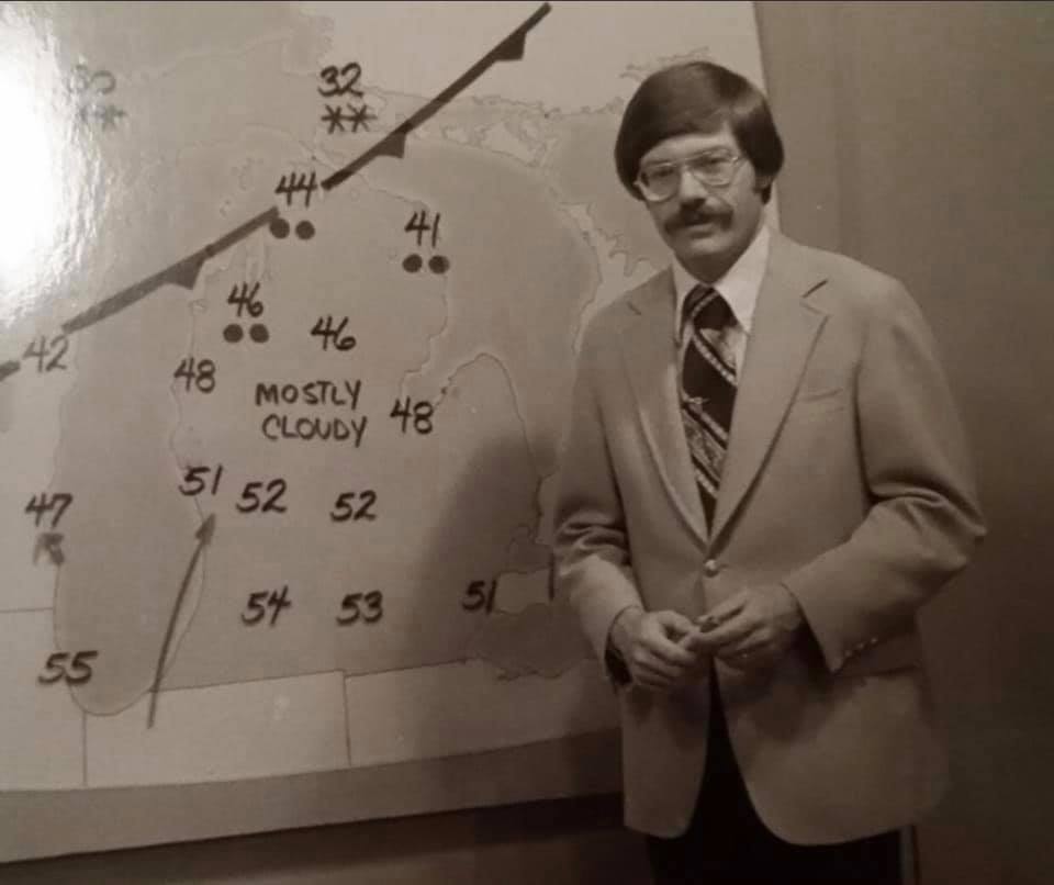
Over the course of Bill’s career in meteorology, technology has evolved. These days, meteorologists use digital maps and computer-generated maps with animations to show West Michigan what to expect, but Bill started out with physical maps.
“Once you had your forecast, all you had to do was go out and draw the state map and the national map — took you 10 minutes,” he said.


“I remember looking at the radar and watching Bill Steffen and thinking, that does not look very impressive on the radar, because at that point, we had greens, yellows, oranges and reds,” Storm Team 8 meteorologist Matt Kirkwood recalled. “That was it. Now with our radar, we can slice dice it.”
The WSR-88D radar was one of the most significant advancements in weather technology.
“Conventional weather radars were fine, but they just allowed us to see where precipitation, snow, hail was and its intensity,” Bruce Smith, the meteorologist-in-charge at the National Weather Service in Grand Rapids, said.
First used in the mid-1990s, WSR-88D now allows meteorologists to both spot precipitation and its motion. That means they can see the rotation of a storm, which can produce early tornado warnings.
“Now that we have just so much more in terms of observations with radar and satellite data, and our supercomputers have undergone so many updates that) it can crunch so much data at such a high rate of speed,” Storm Team 8 Chief Meteorologist Bacca said. “That (has brought) our forecast accuracy way up.”
“In the 2000, (we were) 80% accurate at five days. Now our global models are 80% accurate at seven to eight days,” former NWS meteorologist Bill Marino said. “So just that by itself shows you increase in skill.”
“Back in the day, I mean, a lot of warnings were missed,” Bacca said. “Sometimes we’d get a few hours or maybe a day before a big event, but now I feel like we can see when there’s going to be intense weather five days out.
“I think people are noticing that the forecasts are getting more accurate,” she continued. “They truly are.”