GRAND RAPIDS, Mich. (WOOD) — Temperatures are expected to tumble Thursday night with rounds of arctic air continuing to pour into West Michigan through the weekend and next week.
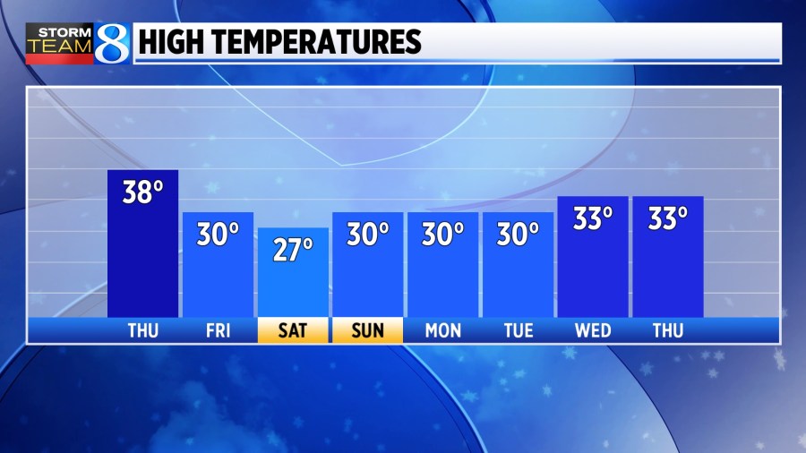
Average highs are in the 40s this time of year, but the rounds of incoming cold should keep West Michigan pinned closer to the low 30s for highs.
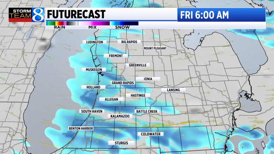
Incoming air will be cold enough to produce lake effect snow showers starting Thanksgiving night and continuing at times through the entirety of next week.
High chance of incoming cold blast
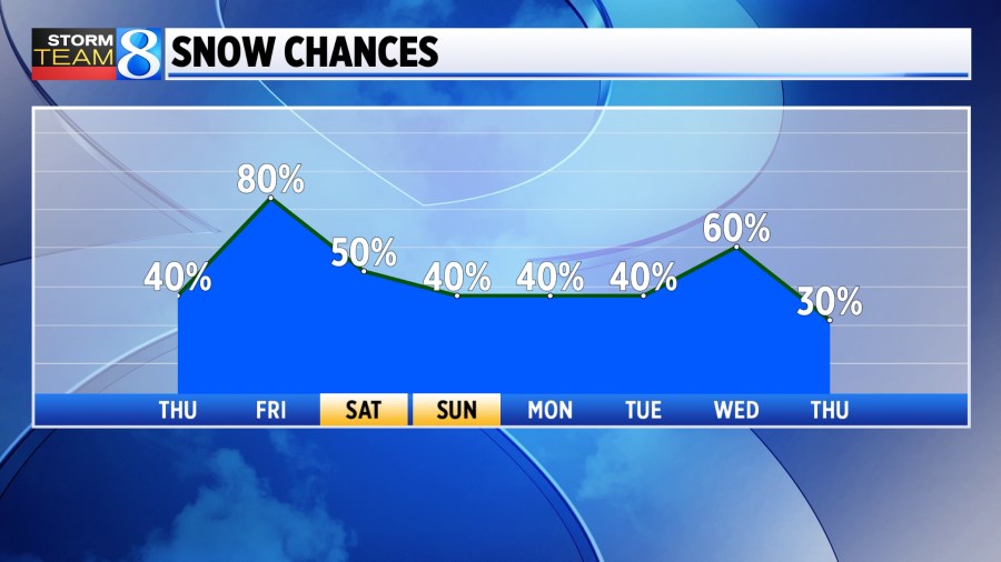
There is high confidence cold air will begin pouring in will produce steady lake effect snow on Black Friday. In some of the heavier bands, 4-6″ of snow is likely, although most in West Michigan will see between 1-4″.
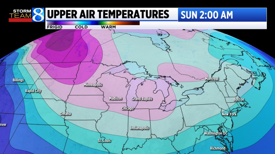
Following Friday, waves of cold air are expected to continue to roll in from the Arctic across the Great Lakes. This should provide several chances for accumulating snow as the month of December kicks off. There is high certainty we will see rounds of snow, but there is still a bit of uncertainty as to the exact timing of each wave.
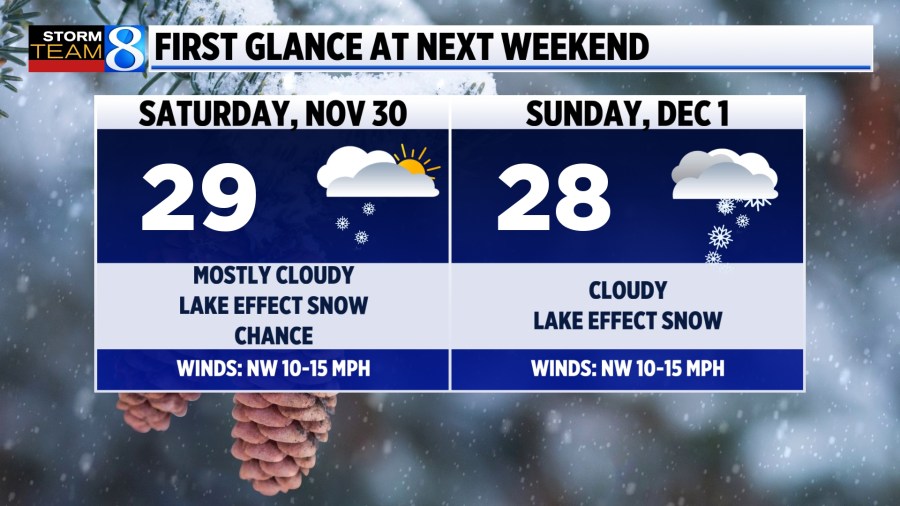
Current forecast trends suggest a wave of energy sparking snow showers on Black Friday with a bit of a lull Saturday — and a new wave sparking more snow showers Sunday.
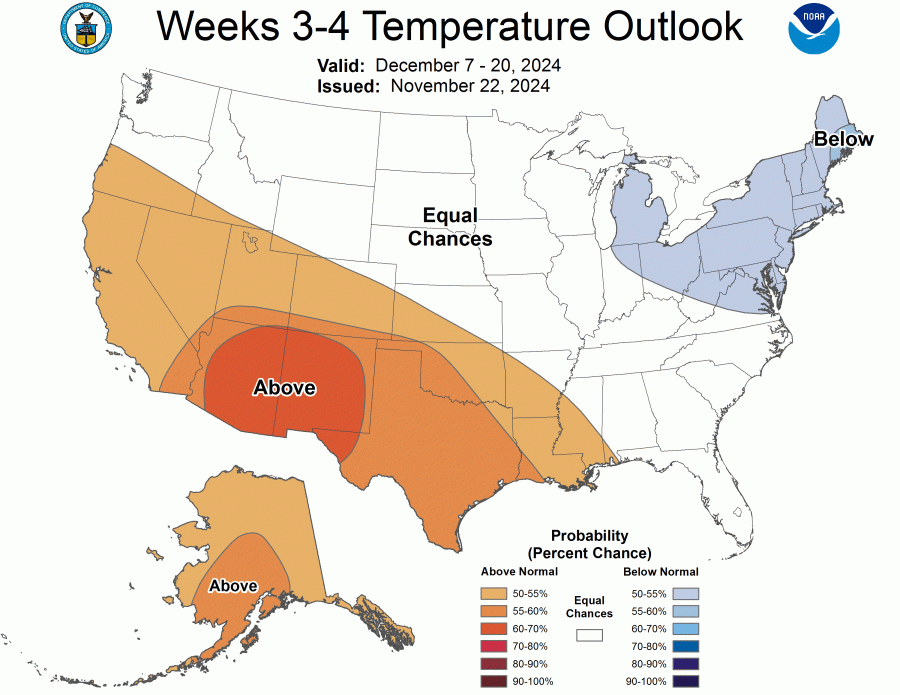
For those with travel plans, stay with Storm Team 8 for the timing of each wave and the breakdown as to who is most likely to be impacted by each. Long-term trends are showing a cooler-than-average lean from Dec. 7-20 as well.
For a look at what winter might bring, check out the full Storm Team 8 winter outlook.