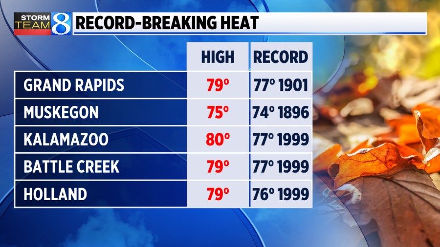
GRAND RAPIDS, Mich. (WOOD) — Following highs near 80° snapping long-standing weather records on Tuesday, we’ll return to record high territory on Wednesday afternoon.
This will be achieved courtesy of a strong southwest flow with gusts upwards of 40 mph at times.
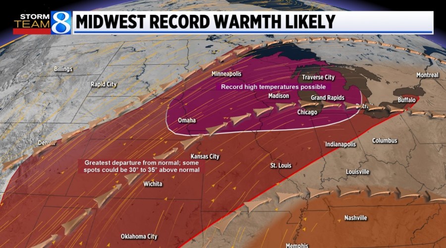
Here’s a list of records that were broken Tuesday, and how warm it will need to be today to break more:

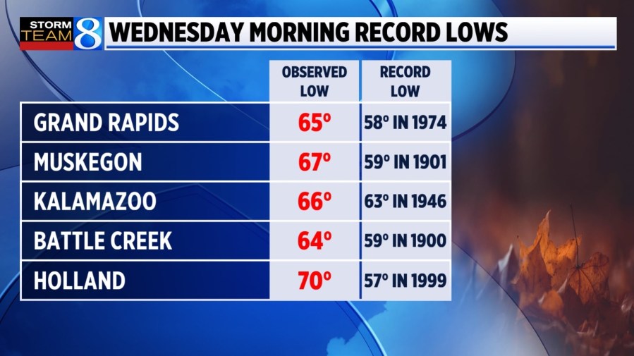
Many new record lows were also broken on the morning of Oct. 30.
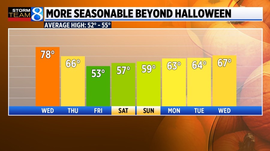
Moving beyond a disturbance that looks to drop a healthy amount of rain — especially during the morning hours of Halloween — we should revert back closer to typical autumn temperatures through the extended forecast. We’ll still be adhering to the warmer end with several days in the upper 50s to mid-60s.
Stay with Storm Team 8 for the latest forecast.