GRAND RAPIDS, Mich. (WOOD) — An active day of weather is expected for Halloween, though the trick-or-treating forecast remains promising.
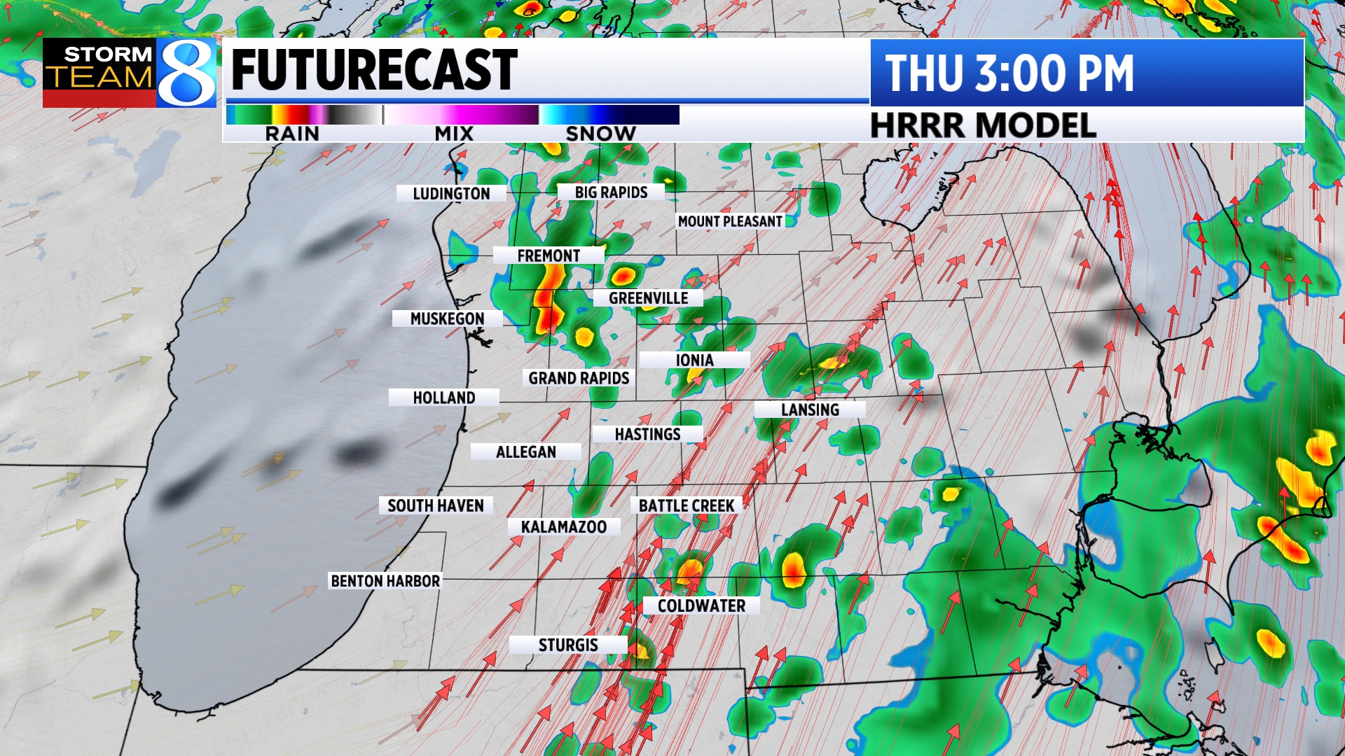
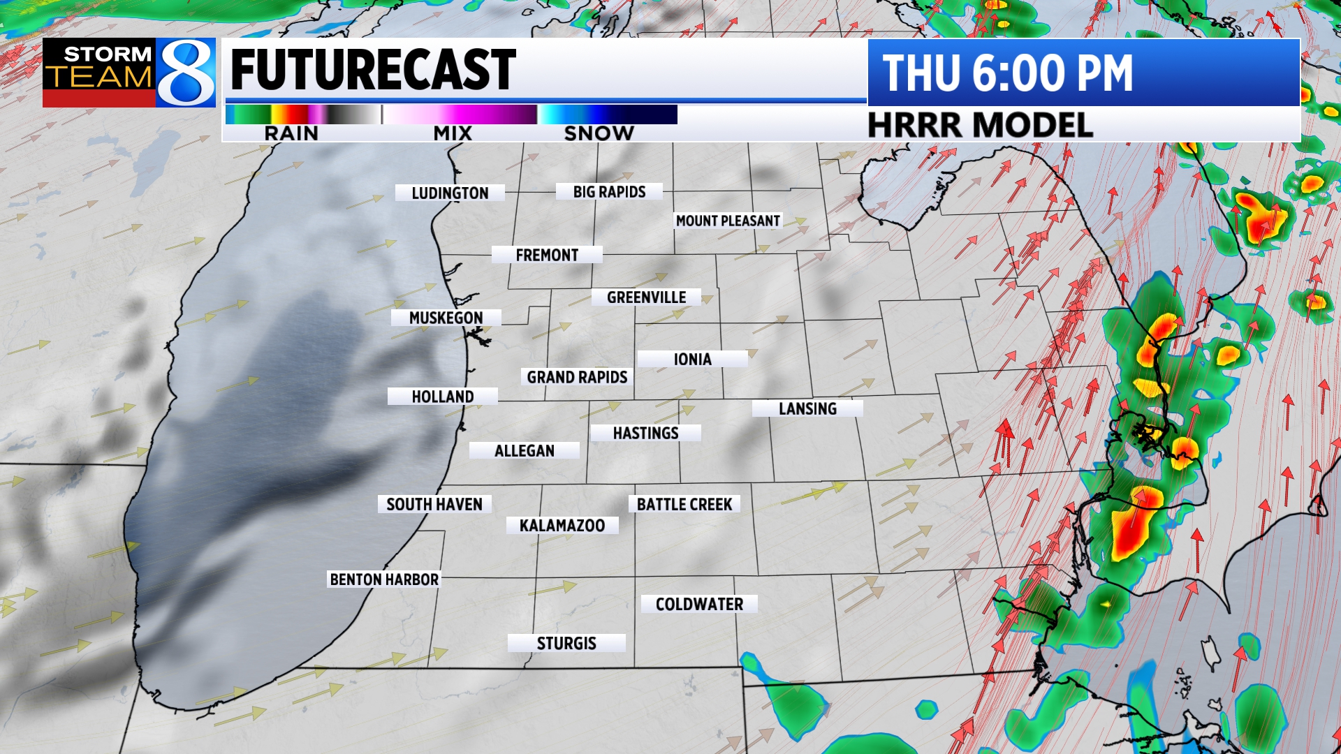
The catalyst for the active weather expected is a cold front that will swing through West Michigan Thursday afternoon.
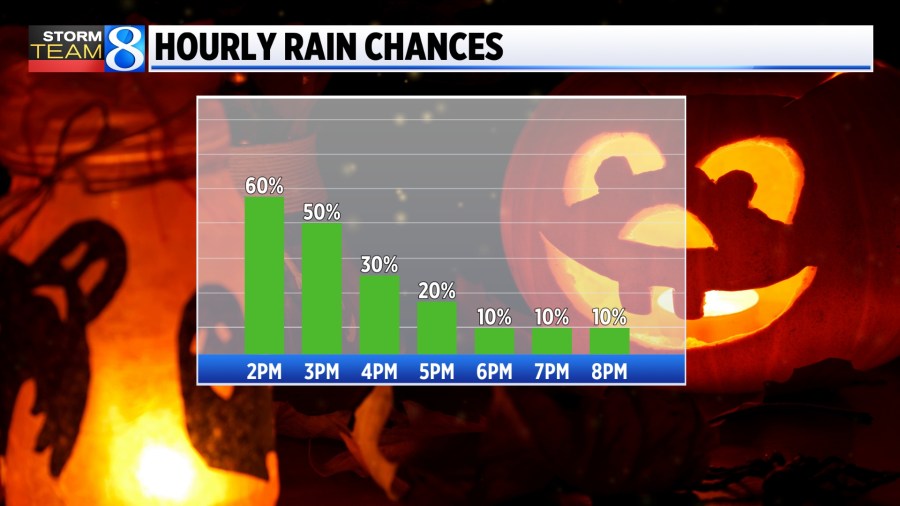
Rain showers arrive this morning, with an embedded thunderstorms possible. On-and-off showers are expected to persist until the cold front passes through in the afternoon, leading to dry conditions for late afternoon and evening.
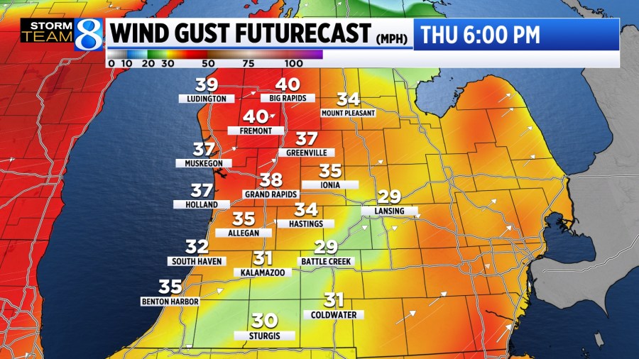
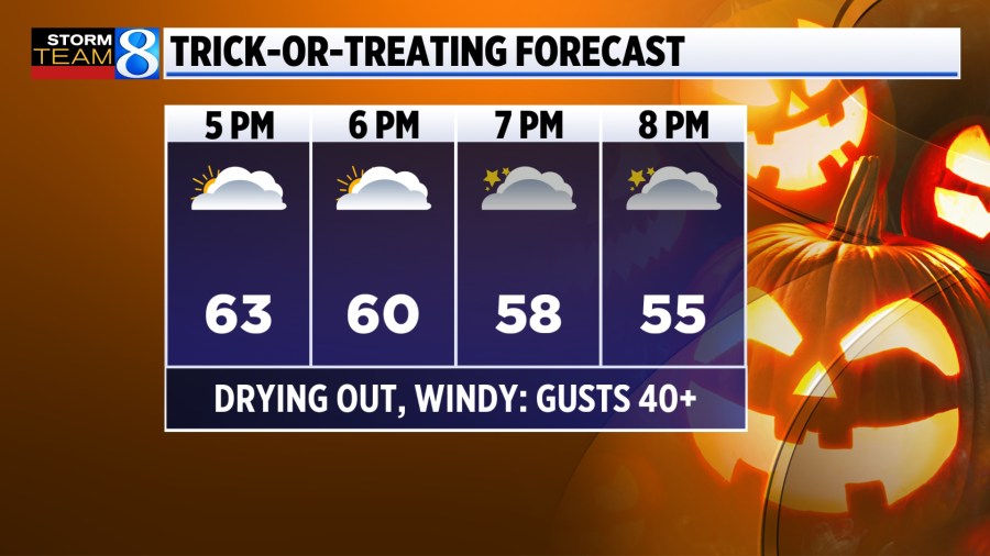
A cold front will plow through this afternoon with strong a strong wind and cooler temperatures, Wind gusts will exceed 40 mph at times especially north of I-94. For the third consecutive day there’s a high wind advisory.

It will still be warm for this time of year but just not record level warmth that we enjoyed the previous couple of days. Any rain will begin departing to the east by mid-afternoon with temperatures sliding to near 60 at 6pm and eventually dipping into the low 50s by 9pm.
Quiet conditions are expected for the first few days of November, followed by additional chances for soaking rains next week. Stay with Storm Team 8 for the latest.