GRAND RAPIDS, Mich. (WOOD) — Lake-effect snow has been stacking up across West Michigan, with some communities recording more than a half-foot of fresh powder.
Snow began late Thursday night and intensified into the day Friday. As of Friday evening, scattered showers were continuing. Snow totals have been significant in some places, with several communities receiving 6 inches or more of lake-effect.
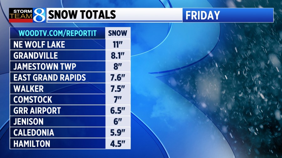
The highest amounts were generally found within 10 to 15 miles of US-131, where widespread totals of 4 to 8 inches were recorded through Friday evening. You can report your snowfall totals here.
The 6.5 inches recorded at the Gerald R. Ford International Airport through early Friday evening is enough to make it the snowiest Nov. 29 on record in Grand Rapids, beating the old record of 4.5 inches in 1960.
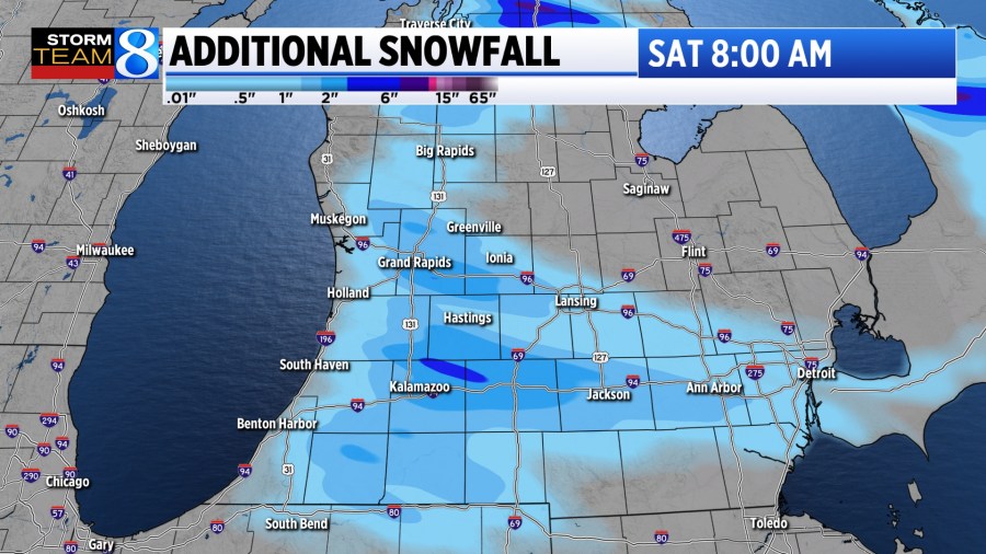
A winter weather advisory remains in effect for the US-131 corridor and lakeshore through 7 a.m. Saturday, where an additional 1 to 3 inches are possible by daybreak. Roads are likely to remain slick in these places until midday Saturday, in which a break from the heavy snowfall should allow for some melting on pavement.
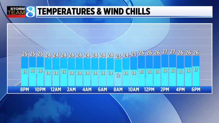
Outside of a few flurries, little snow is expected Saturday. It will still feel like winter, though, thanks to the fresh snowpack and temperatures only reaching the upper 20s. Wind chills will likely be held in the teens through the day.
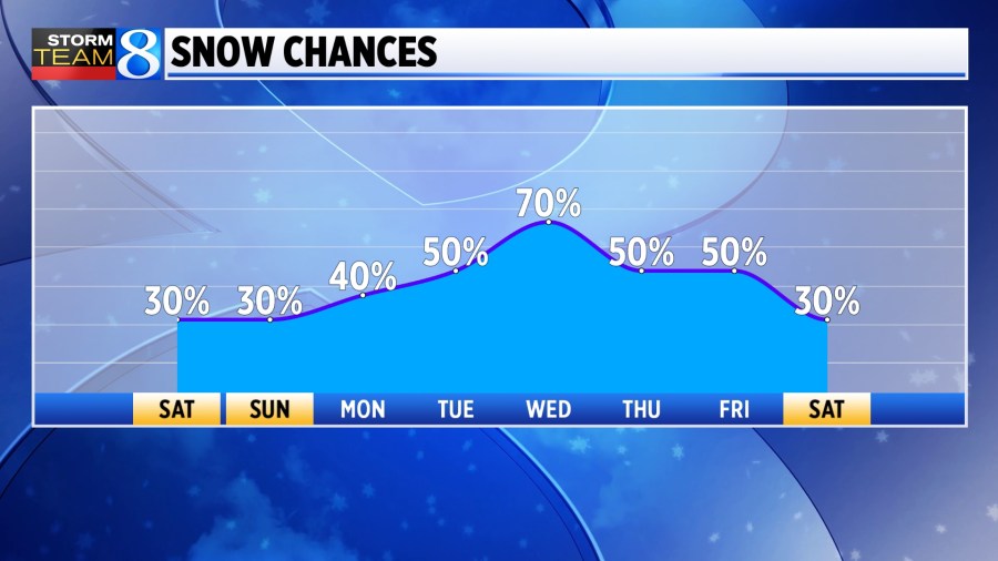
The next timeframe to watch will be late Sunday into Monday, and the area to watch will be northwest-flow favored lake-effect areas. Communities in parts of Ottawa, Allegan, Van Buren and Kalamazoo counties in particular could see another round of meaningful snowfall.
An active stretch of winter weather looks to continue beyond the weekend, with chances for snow (mostly lake-effect) nearly every day.
The Storm Team 8 2024-25 Winter Outlook suggests a strong start to winter with cooler temperatures and snow chances continuing into the first half of December.