GRAND RAPIDS, Mich. (WOOD) — Arctic air will lead to gusty winds and hazardous travel Thursday with whiteout conditions possible at times, especially west of US-131.
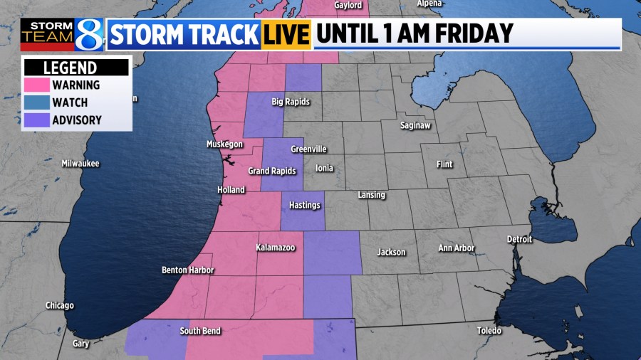
A winter storm warning has been issued for counties west of US-131 through 1 a.m. Friday. A winter weather advisory extends near and east of US-131 with the same start and end times.
HIGH WINDS
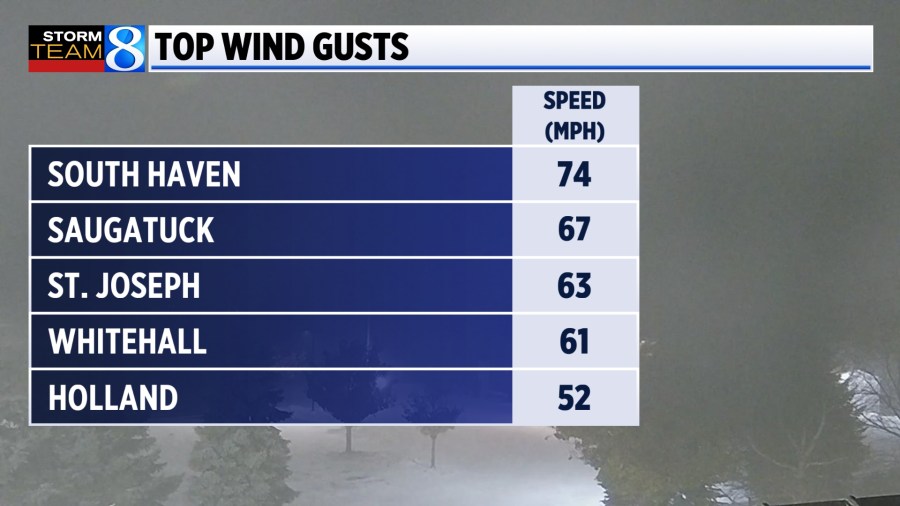
Thousands were without power Wednesday night as the snow and winds rolled through. Gusts were reported in the 40 to 60 mph range.
SNOW TOTALS
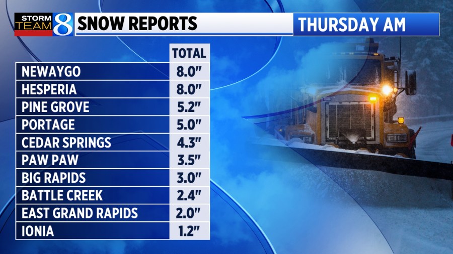
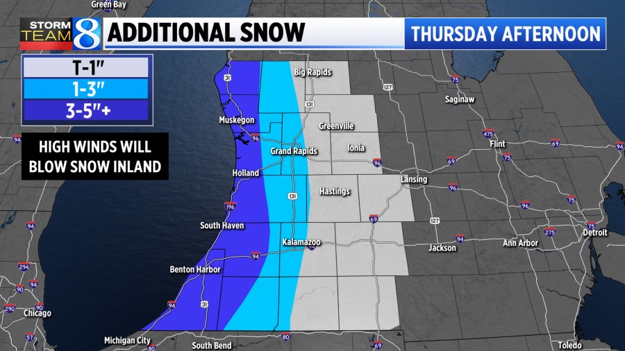
As expected, the highest snow totals remained near and west of US-131 as of Thursday morning. Newaygo and Hesperia reported 8 inches of snow, where as East Grand Rapids saw 2 inches.
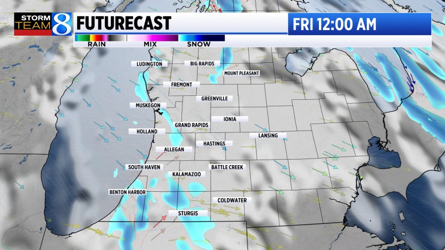
THURSDAY LAKE-EFFECT
Moderate to heavy lake-effect snow bands will continue to set up west of US-131. Ottawa, Allegan, and Van Buren counties are expected to see the highest snow amounts Thursday afternoon. As visibility drops quickly within these bands, travel will be challenging.
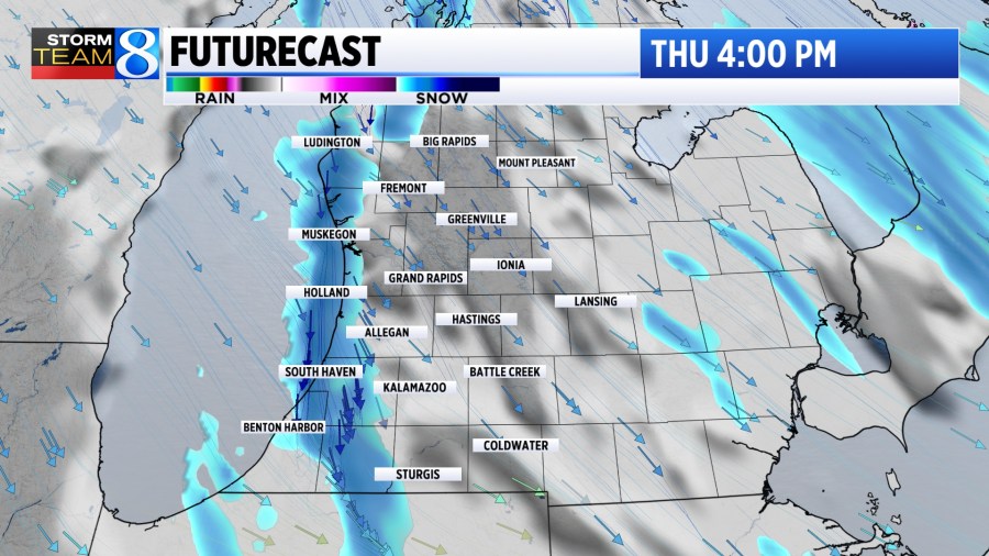
Steady winds near 20 mph and gusts of 30 to 40 mph will cause blowing snow and a quick reduction in visibility. As the system comes to a close late on Thursday, an additional 3 to 5 inches of snow is expected in the heaviest lake-effect snow bands.

Winds will begin to die down late Thursday as well. Cold temperatures will make road salt less effective compared to previous events this season.
MUCH QUIETER FOR THE WEEKEND
A quieter pattern works into West Michigan beginning Friday. As the jet stream lifts a bit farther north, temperatures warm slightly into the mid-30s this weekend.
While next week looks to be active, it will start off with rain rather than snow. Stay with Storm Team 8 for the latest.
You can submit your snow photos at WOODTV.com/ReportIt.