NOTE: This prediction is for Monday, Dec. 2 and is now outdated. See the prediction for Tuesday, Dec. 3 here.
GRAND RAPIDS, Mich. (WOOD) — School closings are likely for some districts along the lakeshore as heavy lake-effect snow develops overnight.
A Winter Storm Warning has been issued for Ottawa, Allegan and Van Buren counties from late Sunday night through late Monday. Within this area, some communities could see very heavy snowfall.
Lake-effect bands are expected to intensify late this evening, continuing overnight. Parts of south-central Ottawa and north-central Allegan counties could be hit by heavy snow for the first part of the night, before snow migrates closer to the lakeshore toward daybreak. Heavy snow is expected close to the lakeshore through the day Monday, especially south of Holland.
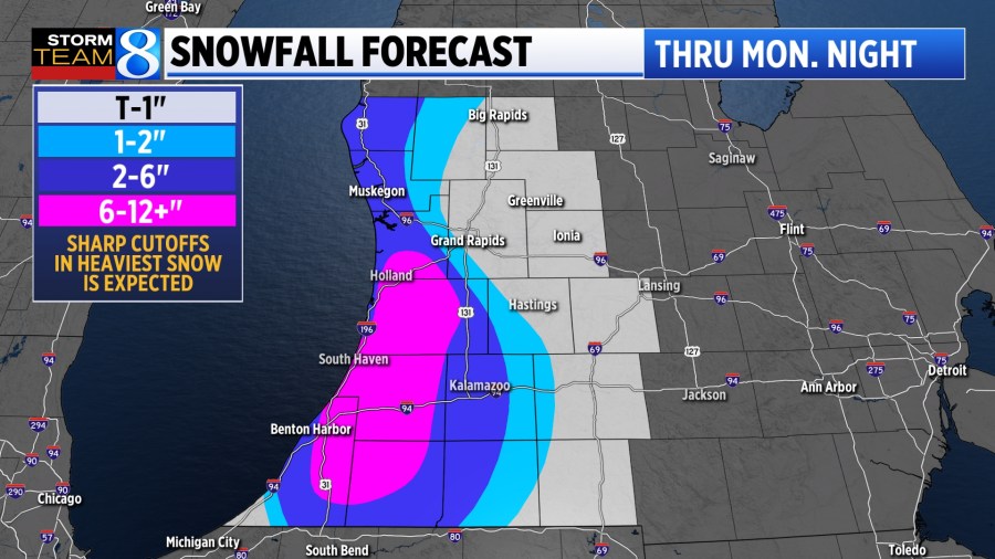
As is usually the case with lake-effect, snow totals will vary greatly from one town to the next. The communities that end up under the heaviest snow may well see totals exceed a foot. This is most likely south of Holland and west of US-131. Grand Rapids is unlikely to see much, if any accumulating snow from this event.
Blake Harms will have more on what’s expected tonight on News 8 at 6, 10 & 11, on his Instagram page at 7:30 p.m. and on his Facebook page at 8 p.m.
PREDICTION: Ottawa & Kent counties
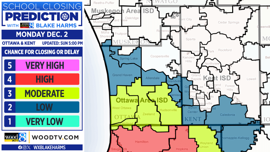
Southern Ottawa county has the best chance in the greater Grand Rapids area of seeing school closings. At this time, those districts include Hudsonville, Zeeland, West Ottawa and Holland. There is still some uncertainty as to how far north the heavy snow is able to materialize, but the chance is high enough for a 3/5 moderate chance for closing. This could change depending on how the evening unfolds.
Elsewhere, including in the Grand Rapids area, snow is likely to remain to the southwest and is very unlikely to cause school closings.
PREDICTION: Southern area
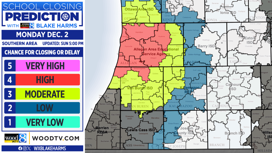
Based on current forecast trends, the best chance for school closings in West Michigan appears to be in western Allegan and northern Van Buren counties. It’s here where the most persistent, heavy snow is likely through the morning commute and beyond. A 4/5 high chance for closing is in place for Hamilton, Saugatuck, Hopkins, Allegan, South Haven, Bloomingdale and Glenn.
Kalamazoo is likely to be on the periphery of the heaviest snow, but closings aren’t impossible in Kalamazoo County, depending on how far inland the snowbands can reach. There is also a non-zero chance of a secondary heavy band to develop in the vicinity of I-94, which would raise closing chances in Kalamazoo & Van Buren counties if it materializes.
PREDICTION: Northern area
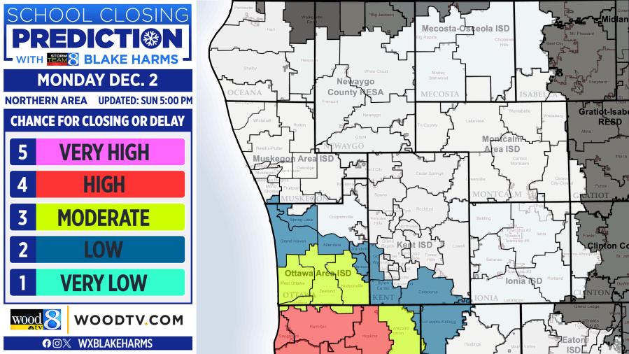
While heavy snow may develop for parts of Muskegon and Oceana counties Monday, it’s unlikely to have much of an impact on the morning commute. A relatively better chance of closings may exist in these areas Tuesday.
LOOKING AHEAD
Monday’s snowfall will determine Tuesday’s closing chances, with a handful of closings possible in the hardest-hit areas. There is also a growing chance for widespread lake-effect, frigid wind chills and blowing snow for parts of West Michigan Thursday, which could lead to additional school closing chances.