
Chances are improving that an Arctic Blast will move south into the Central/Eastern U.S. as we close out the month of November and move into the month of December.
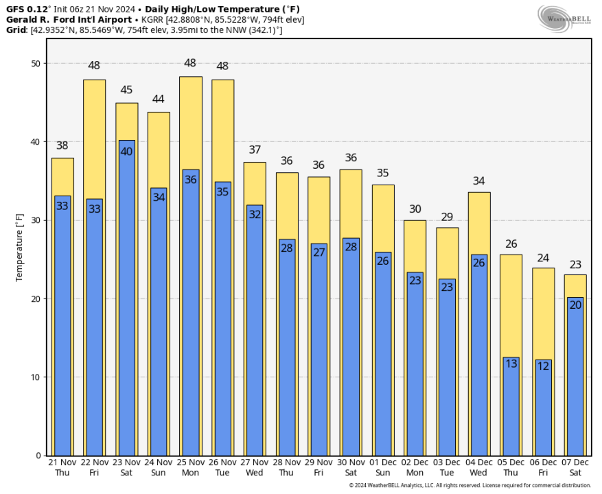
Here’s a look at forecast high and low temperatures for Grand Rapids from the overnight run of the GFS model. Now, keep in mind that the GFS is sometimes premature and/or overdone with cold air blasts in fall and early winter…but…the general trend is that colder air is on the way and it’s going to stick around into at least early December.
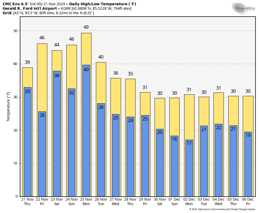
The Canadian model forecast highs and lows has the same story. Arctic air arrives around the 27th and sticks around through at least the first week of December.
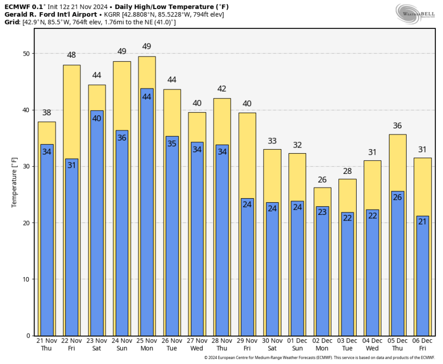
Here’s the Thursday morning run of the European model. It also has colder air moving in around Nov. 26th-27th.
The water temperature of Lake Michigan is still at 51.7° this morning at the Muskegon buoy (6-foot waves out there this AM), so the potential is there for some significant lake-effect snowfall.
Check out this from Michigan-native, Dr. Ryan Maui from Weather and Climate Substack:
“We are flipping to full-tilt winter by (the) end of November. Prepare for cold and snow and potential for major Arctic blast in 10-day range, with huge snowfall totals due to influx of Pacific moisture. Very wintry pattern ahead.”
This could mean an early start to winter sports in Michigan and the Great Lakes.
I’ve been looking at what we call “analog years”…years when we had similar weather conditions to see what the winter weather was like. This year we have a neutral pattern/weak La Nina in the Equatorial Pacific. We had a big hurricane season in the Southeast. We were sunny and relatively warm in September and October in the Great Lakes.
One fairly similar year was 2005 – the year of Hurricane Katrina. That year we turned cold early. Grand Rapids had 17.3″ of snow in the last two weeks of November and another 28.3″ in December. The warmest temperature in G.R. during the first 10 days of December was 29°.
We then flipped to a relatively mild pattern in early January (2006) when we had only 1/2″ of snow in the first 17 days of the month.
ALSO: After a very sunny September/October, we’ve had only 25% of possible sunshine this November. We’ve had 12 days with 10% or less of possible sunshine. November 1-20 was 6.4 degrees warmer than average in G.R. Rainfall has totaled 2.62″ and that’s 0.45″ above average.
A weather spotter in Ravenna reported 1-2″ of snow on the grassy areas this early morning. I had about 1/2″ on the grass this AM in Alpine Township. The pavement is warm and roads are generally just wet in Michigan.
As I type this, waves are running 6 feet at the Muskegon buoy.
Here’s radar – the band of heavier snow in eastern Wisconsin is moving north to south


