
The computer models continue to forecast an Arctic outbreak starting around Thanksgiving Day and lasting into at least the first week of December.
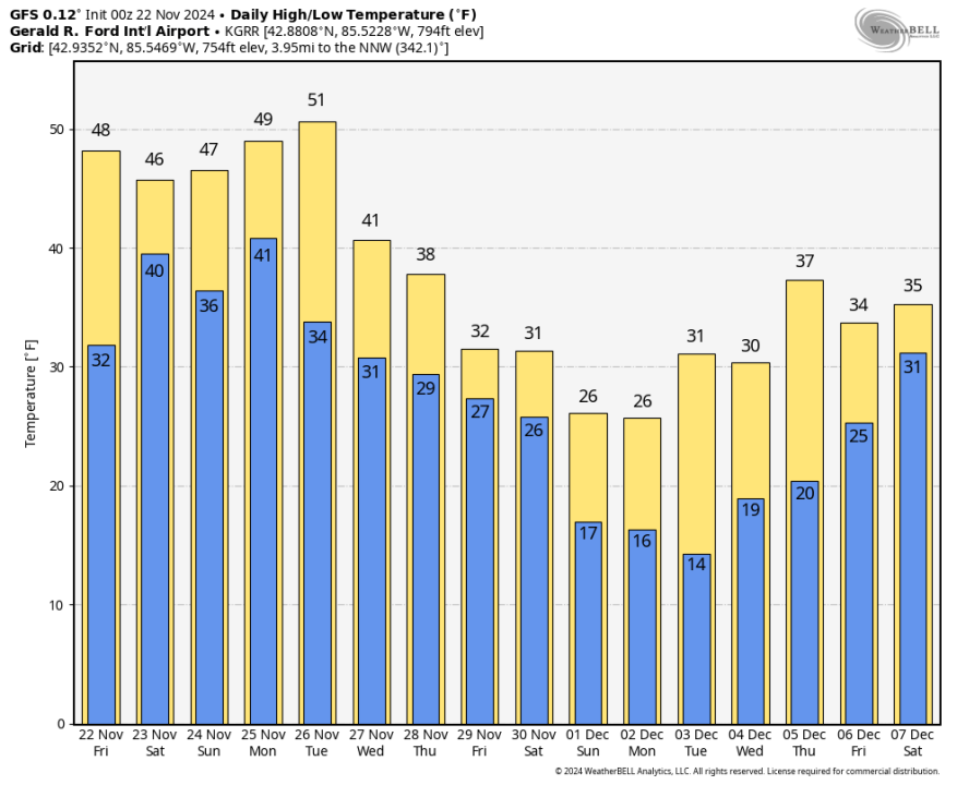
Here’s the forecast high and low temperatures from the overnight run of the GFS model. We’re still relatively mild through November 26 (the average high temperature in Grand Rapids for today is 44° and that falls to 41° by the end of the month). Then the cold air moves in and sticks around through at least the first week of December.
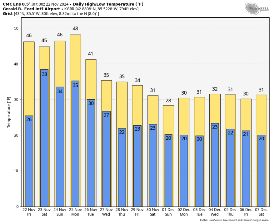
This is the forecast high and low temperatures for Grand Rapids from the overnight run of the Canadian model. Lots of cold air from from Nov. 27 through the first week of December.
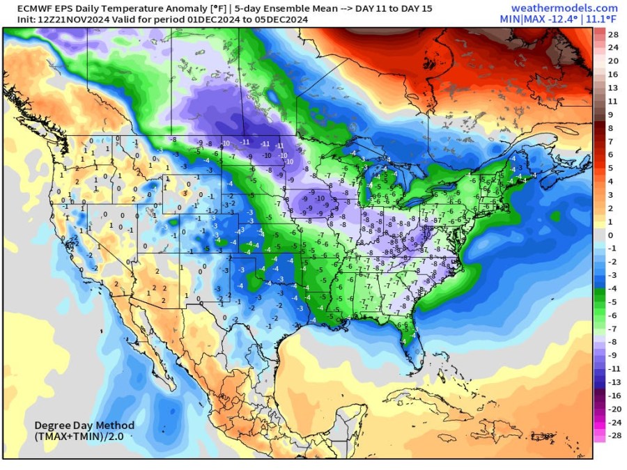
This is the temperature departure from average for December 1-5 from the European model. West Michigan is forecast to be about 6 degrees colder than average. The average high temperature is 41° on Dec. 1. It drops to 39° by Dec. 5.
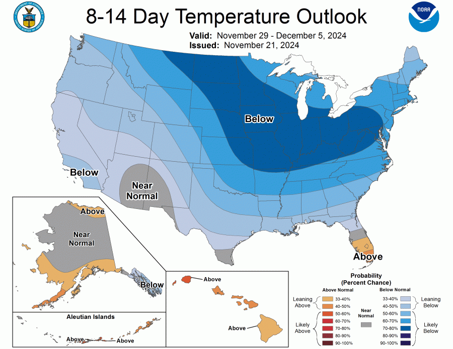
Here’s the 8-14 Day Temperature Outlook from the Climate Prediction Center for Nov. 29 – Dec. 5. Most of the country is forecast to be colder than average. The only area expected to be warmer than average in the Lower 48 states is the southern half of the Florida Peninsula.
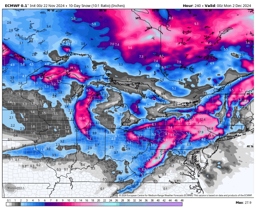
Here’s 10-day total snowfall from the European model. With a northwest wind, you can see the heavier (lake-effect) snow favors the lakeshore areas, especially from South Haven into northern Indiana. The model is also forecasting significant lake-effect snow downwind from the other Great Lakes and in the higher elevations from northern New England down to the Pocono Mountains of Pennsylvania down to the Smoky Mountains along the border between TN an NC.
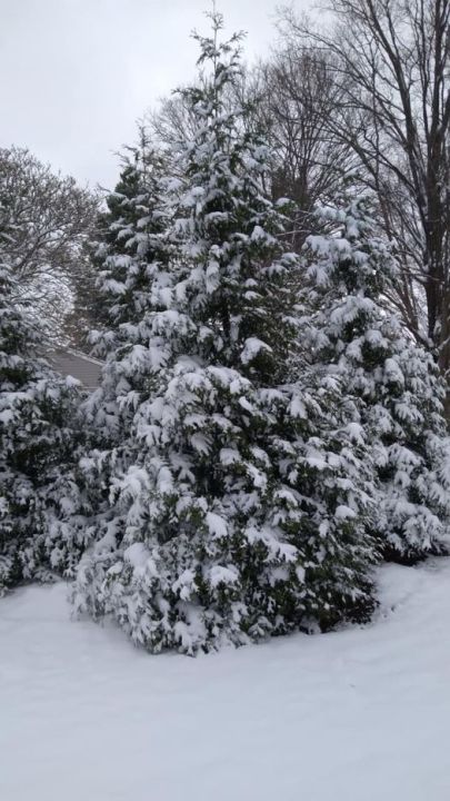
This was Buchanan, Michigan in Berrien Co. after 4″ of snow there early Thursday (pic. from Amber Krycka). LaGrange in Cass Co. had the most snow with 4.8″. Other snowfall totals: 4″ at Rolling Prairie, 3.5″ at Niles, 2 inches at Allegan and Ravenna and just 1/4″ at the Grand Rapids Ford Airport.
Sunrise today (Fri.) for Gr. Rapids is at 7:43 am and sunset will be at 5:13 pm. The shortest daylight of the year occurs over the next two months.
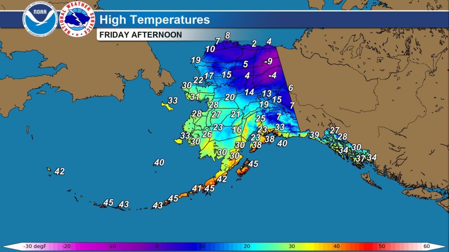
Here’s forecast high temperatures for Alaska for today. It’s cold in northeast Alaska (and across the border into the Yukon Territory. A couple spots are forecast to stay below zero all day. Currently Anchorage has 11″ of snow on the ground. Northway has a 10″ snow cover. It was -19° at Arctic Village Thursday morning.
This was U.S. snow cover Thursday. Approximately 14.8% of the continental U.S. had snow on he ground with a fair amount of snow on the ground in the western mountains. Check out these ski pictures taken Wednesday at Mt. Baker in Washington State. They had 10″ of snowfall on Wednesday and they’re up to an 84″ base (at Pan Dome). There was a 3-day rainfall total of 5.38″ at Staircase WA in Olympic National Park.


