GRAND RAPIDS, Mich. (WOOD) — Lake effect winds down on a cloudy Tuesday.
TODAY Snow showers, mostly cloudy
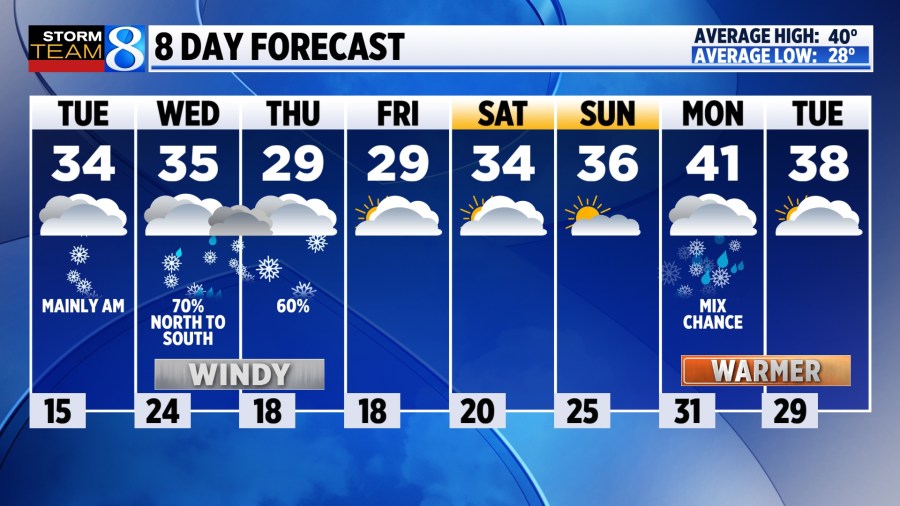
LOW 15 inland to 25° near the lakeshore
HIGH 34°
WIND W 5-10 mph
Check out current school closings here.
TODAY Scattered snow shower activity should gradually diminish through the day. Winds will begin to shift out of the southwest, with highs back near freezing.
TONIGHT A system will clip West Michigan bringing a chance for snow showers north of I-96. Lows will dip down to the mid 20s.
WEDNESDAY A few lingering snow showers for Wednesday morning before drier air works in. Strong southwest winds will allow temperatures to warm into the mid 30s. A light snow / rain mix will develop through the afternoon, transitioning back to snow in the evening. Watch for areas of flash freeze. Lake effect snow is expected to ramp back up close to the lakeshore as cold air pours in.
THURSDAY Windy and snowy conditions are expected, especially close to the lakeshore as lake effect intensifies. Several inches will be possible in spots, along with blowing and drifting snow. It will be chilly, with highs in the upper 20s and wind chills in the single digits to lower teens.
LOOKING AHEAD Drier air begins to prevail with temperatures warming slightly to the mid 30s.