GRAND RAPIDS, Mich. (WOOD) — Thursday’s winter storm delivered snowfall amounts ranging from one to 10 inches and peak gusts between 60 to 73 mph. Friday will deliver much quieter conditions.
TODAY Mostly cloudy, chance of sun
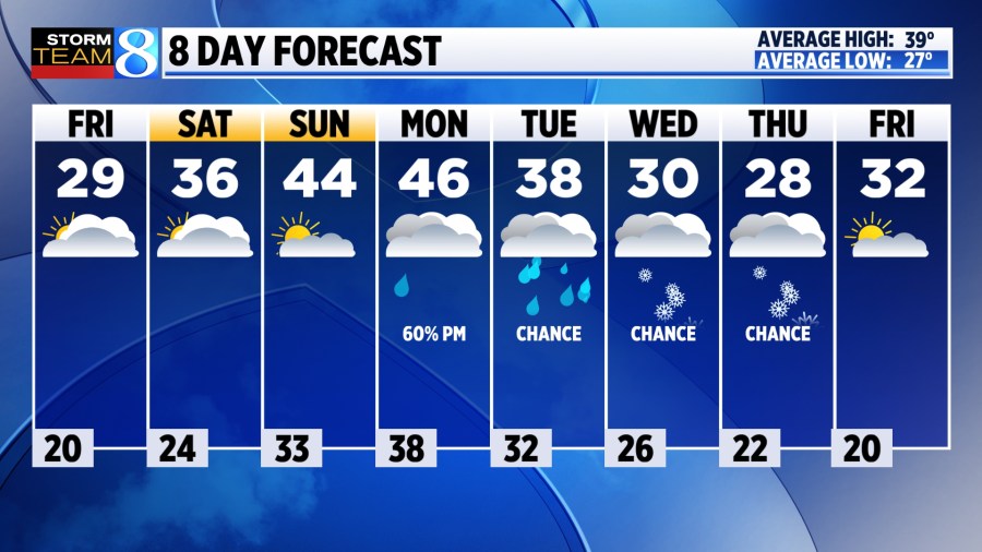
LOW 20° (some teens)
HIGH 29°
WIND W 5-15 gusting 20 mph
TODAY Much quieter with some areas of sunshine. Highs will be near 30°. Wind will be much lighter, out of the west at 5-15 mph. A few gusts near 20 mph are possible.
TONIGHT Mostly cloudy and quiet with lows in the mid 20s.
SATURDAY Mostly cloudy with a sweep of snow expected north of Grand Rapids, impacting areas near Traverse City and north. Little to no accumulation is expected in West Michigan. Temperatures continue to warm with highs in the mid 30s in West Michigan with mostly dry conditions and winds our of the southwest at 10 mph.
SUNDAY Partly sunny with highs warming into the mid 40s. Pleasant, with widespread melt.
LOOKING AHEAD Slightly above-average temperatures continue next week favoring rain Monday. A chance for some lake-effect develops for Wednesday and Thursday.