GRAND RAPIDS, Mich. (WOOD) — Rain will hang around all day today with a light shower possible at any time. Today will be the warmest day of the week.
Cold, snow: sharp pattern change ahead
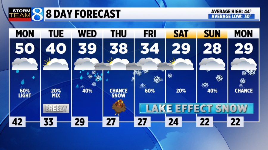
TODAY Cloudy with light rain showers
LOW 42°
HIGH 50°
WIND ESE 5-10 mph
TODAY Scattered light rain showers are likely through most of the day ahead of a cold front. It will be cloudy and mild for this time of year with highs near 50 degrees. Wind won’t be overly strong, out of the east at 5-10 mph.
TONIGHT As temperatures dip to near freezing, a light wintry mix and flurries will develop into early Tuesday. No accumulation is expected.
TUESDAY Mostly cloudy and chilly with a stiff wind out of the northwest. Temperatures will fall through the day to the upper 30s. A light wintry mix is possible in the morning, and again during the evening commute. Winds may gust to 25 mph.
WEDNESDAY Mostly cloudy skies are expected, along with highs in the upper 30s. There is a chance for a light rain or snow mix to form, especially south of Grand Rapids as a system slides south of Michigan.
THANKSGIVING Chilly, with morning lows in the upper 20s and areas of light mix possible. Expect afternoon highs in the 30s with a chance of light lake effect snow forming in the afternoon and evening. Snow after dark might make roads quite slick. Stay with Storm Team 8 for the latest.
LOOKING AHEAD A significant pattern change to colder, and potentially snowy weather looks likely for the end of the week. Lake-effect snow is likely for Black Friday, and at times through the weekend into next week.