GRAND RAPIDS, Mich. (WOOD) — A winter storm will continue to pour Arctic air into the region Thursday, creating blowing snow and areas of intense snowfall with wind chills in the single digits to teens.
Check to see if your school is closed here.
Winter Storm Warning in effect for counties west of US-131 until 1 AM Friday.
Winter Weather Advisory in effect for counties along and east of US-131 until 1 AM Friday.
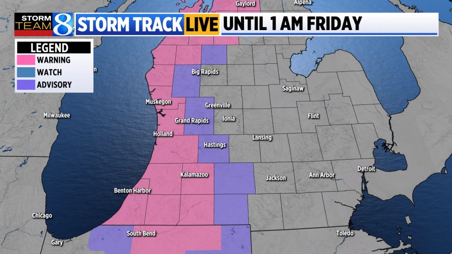
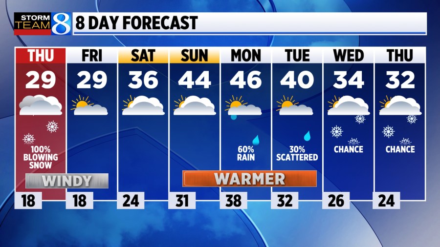
TODAY Areas of heavy snow along/west of 131. Areas of blowing snow for everyone.
LOW 20° (feeling like the single digits)
HIGH 29° (feeling like the teens)
WIND NW 15-20 gusting 30-40 mph
TODAY Windy and snowy conditions are expected with several rounds of lake effect through the day. It will be chilly, with highs in the upper 20s and wind chills in the single digits to lower teens. Accumulation will range from 3 inches to 8 inches in the warning area. Blowing and drifting are likely with whiteout conditions expected at times. Areas along and east of 131 might see blue sky at times.
TONIGHT Wind relax as snow comes to a gradual close around midnight. Temperatures remain frigid with lows in the upper teens.
FRIDAY Much quieter with some areas of sunshine. Wind will be much lighter, out of the west at 5-10 mph with temperatures near 30.
WEEKEND A fairly pleasant weekend with partly to mostly cloudy skies. Temperatures continue to warm with highs in the mid 30s on Saturday and mid 40s on Sunday. This will favor some melting to take shape.
LOOKING AHEAD Slightly above average temperatures continue next week favoring rain over snow. A chance for some lake-effect develops for Wednesday and Thursday.
You can submit your snow photos at WOODTV.com/ReportIt.


