GRAND RAPIDS, Mich. (WOOD) — Following a few warm days that helped melt away much of our snow cover in West Michigan, our next winter storm is now taking shape.
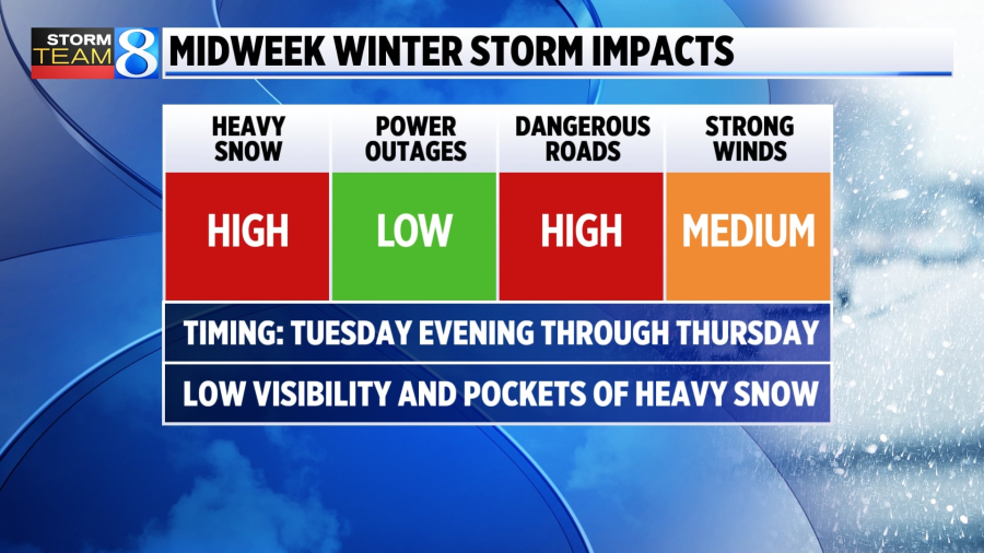
A winter storm watch will be in effect starting Tuesday evening and continuing through Thursday evening.
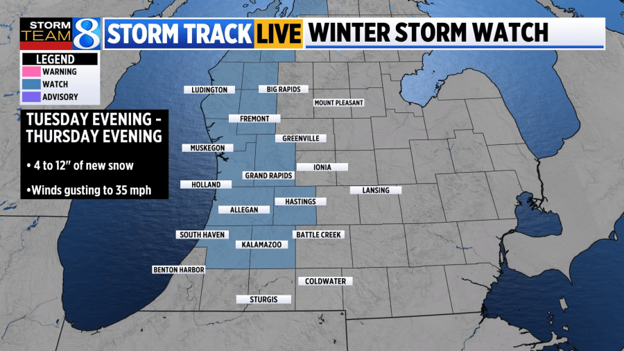
Widespread snow totals exceeding 4 inches will be possible with isolated greater amounts near 12 inches approaching the lakeshore associated with lake-effect snow bands.
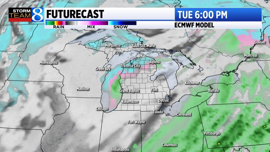
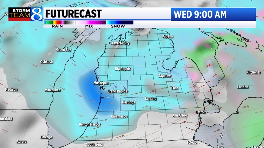
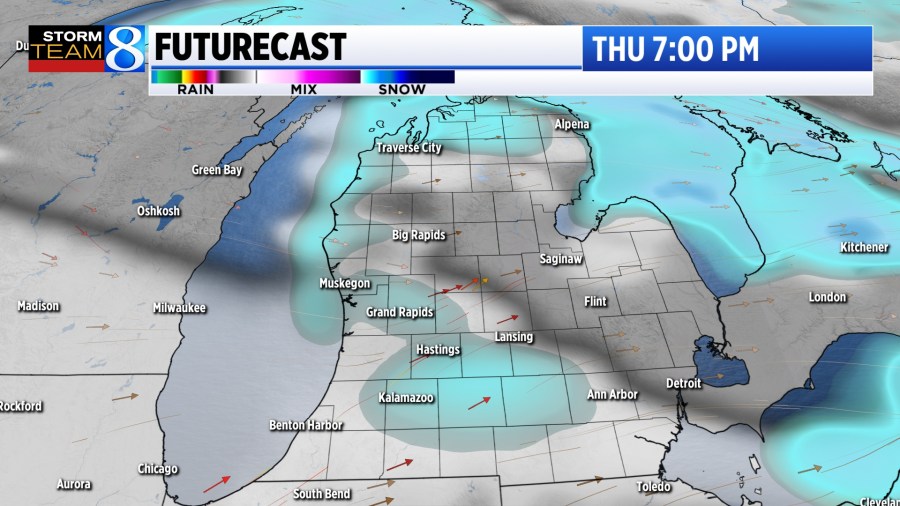
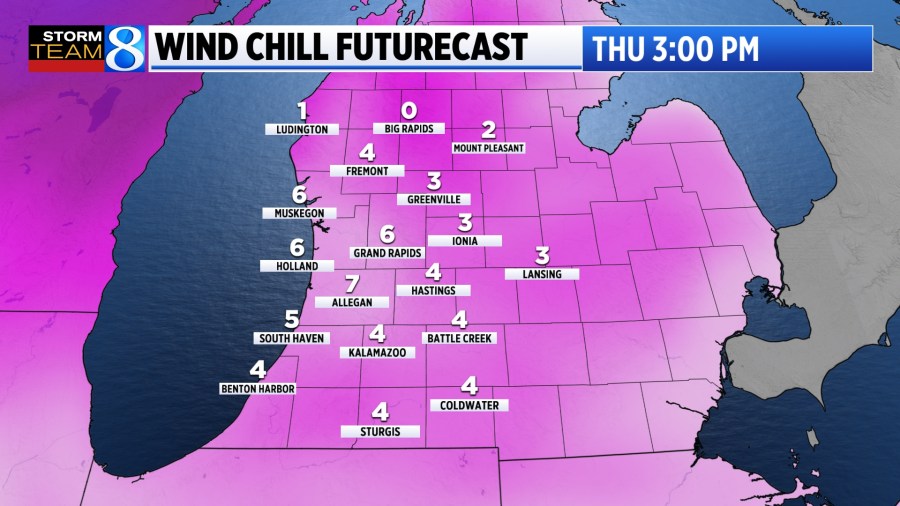
Precipitation likely begins as we approach Tuesday evening, when it will be warm enough at first for a few raindrops to mix in. Colder air pours into West Michigan Tuesday night, shifting the precipitation fully over to snow. Snow is expected to fall at its heaviest during the day Wednesday. We should see the snow gradually taper off into Thursday evening.

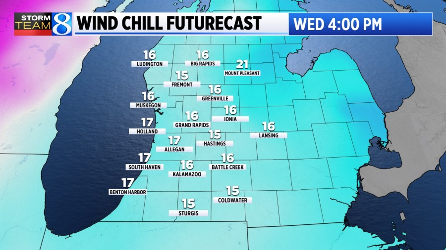
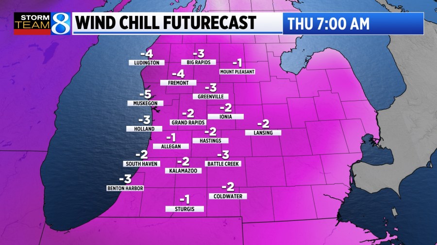
The wind will also play a factor with this storm with gusts reaching near 35 mph. This will not only create hazardous driving conditions with lowered visibility, but also produce bitterly cold wind chill values, which will sink below zero Thursday morning.
The wind won’t be quite as forceful as it was with the system that occurred during the first week of December and therefore the concern over power outages is lower. Even still, pockets of heavy snow and gusty winds will create significant impacts — especially for travel.
Stay with Storm Team 8 as we bring you further information on this storm.